


ADAMS 2 Voting District, LaSalle County, Illinois
About
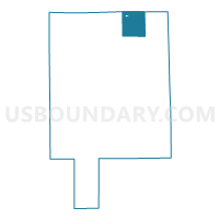
Outline

Summary
| Unique Area Identifier | 572527 |
| Name | ADAMS 2 Voting District |
| County | LaSalle County |
| State | Illinois |
| Area (square miles) | 32.57 |
| Land Area (square miles) | 32.57 |
| Water Area (square miles) | 0.00 |
| % of Land Area | 100.00 |
| % of Water Area | 0.00 |
| Latitude of the Internal Point | 41.58436150 |
| Longtitude of the Internal Point | -88.76479660 |
Maps


Graphs
Select a template below for downloading or customizing gragh for ADAMS 2 Voting District, LaSalle County, Illinois


Neighbors
Neighoring Voting District (by Name) Neighboring Voting District on the Map
- ADAMS 1 Voting District, LaSalle County, IL
- EARL 1 Voting District, LaSalle County, IL
- EARL 2 Voting District, LaSalle County, IL
- FREEDOM 1 Voting District, LaSalle County, IL
- NORTHVILLE 1 Voting District, LaSalle County, IL
- NORTHVILLE 6 Voting District, LaSalle County, IL
- SERENA 1 Voting District, LaSalle County, IL
- SOMONAUK 2 Voting District, DeKalb County, IL
- VICTOR 1 Voting District, DeKalb County, IL
Top 10 Neighboring County Subdivision (by Population) Neighboring County Subdivision on the Map
- Northville township, LaSalle County, IL (7,410)
- Earl township, LaSalle County, IL (2,595)
- Somonauk township, DeKalb County, IL (2,101)
- Adams township, LaSalle County, IL (1,646)
- Serena township, LaSalle County, IL (1,138)
- Freedom township, LaSalle County, IL (663)
- Victor township, DeKalb County, IL (299)
Top 10 Neighboring Place (by Population) Neighboring Place on the Map
Top 10 Neighboring Unified School District (by Population) Neighboring Unified School District on the Map
- Community Unit School District 2, IL (6,325)
- Somonauk Community Unit School District 432, IL (5,067)
- Leland Community Unit School District 1, IL (1,824)
Top 10 Neighboring State Legislative District Lower Chamber (by Population) Neighboring State Legislative District Lower Chamber on the Map
- State House District 50, IL (178,899)
- State House District 75, IL (125,585)
- State House District 70, IL (121,976)
- State House District 76, IL (105,699)
Top 10 Neighboring State Legislative District Upper Chamber (by Population) Neighboring State Legislative District Upper Chamber on the Map
- State Senate District 25, IL (332,979)
- State Senate District 35, IL (245,609)
- State Senate District 38, IL (231,284)
Top 10 Neighboring 111th Congressional District (by Population) Neighboring 111th Congressional District on the Map
Top 10 Neighboring Census Tract (by Population) Neighboring Census Tract on the Map
- Census Tract 9617.01, LaSalle County, IL (6,355)
- Census Tract 9618, LaSalle County, IL (4,006)
- Census Tract 18, DeKalb County, IL (4,002)
- Census Tract 9617.02, LaSalle County, IL (3,200)
- Census Tract 19, DeKalb County, IL (2,431)